The South Albany Area Plan (SAAP) represents the culmination of an 18-month planning project that presents the community vision for South Albany, Albany's largest undeveloped area.
It sets the direction for future growth and development in this area including zoning and land use, streets and highways, railroads, natural areas and wildlife along Oak Creek, neighborhood services, and development standards. Additionally, the SAAP identifies how much development can be approved before the realignment of Ellingson Road is required.
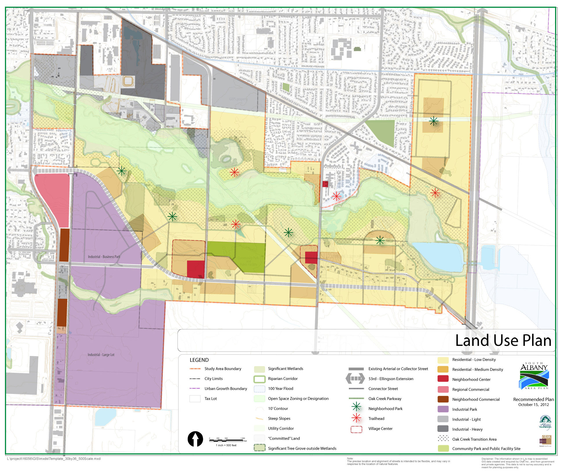
Study Area
The study area is generally all lands between Interstate 5 on the east and Highway 99 on the west, and vacant lands surrounding Oak Creek on the north, then south to the Urban Growth Boundary.
Project Objectives
The City’s goals were to lay the framework to create a vibrant new community that will be appealing to residents and businesses seeking new sites. The project objectives were to.
- Identify feasible patterns of land uses that are consistent with the City's goals for urbanization and environmental protection.
- Consider the capacity of existing, planned, and needed infrastructure facilities to serve the new development in a logical and orderly manner.
- Identify transportation facilities needed for circulation of motor vehicles and people walking and cycling.
- Provide rail service to industrial properties by protecting existing and future right-of-way for service to industrial properties.
- Reduce reliance on automobiles for short trips within the area, and between the area and surrounding development.
- Establish alignment and design standards for the Oak Creek Parkway to create a street that defines the southern edge of open space along Oak Creek, provides accessibility to parks and recreation facilities and that is integrated with surrounding development and other transportation facilities; prepare recommendations for low-impact development for environmentally-sensitive areas within the vicinity of Oak Creek.
Plan
View the South Albany Area Plan
Introduction
- Purpose of Project
- Study Area
- Document Contents
- Planning Process
Existing and Future Conditions
- Planning Area Context
- Past Planning in South Albany
- Existing Land Use Conditions
- Existing Transportation Conditions
- Market Analysis Summary
- Buildable Lands Analysis
South Albany Area Plan
- Overview
- Vision and Plan Objectives
- Organizational Framework
- Streets Framework
- Trails Framework
- Park and School Concept
- Land Use Plan
Implementation
- Comprehensive Plan and Zoning
- Transportation System Plan
- Funding Strategy
Appendix
- Appendix A – Task 1: Project Kick-off
- Appendix B – Task 2: Existing and Future Conditions
- Appendix C - Public Event #1
- Appendix D - Land Use and Transportation Alternatives
- Appendix E - Public Event #2 and Preferred Alternative
- Appendix F - Plan Implementation
- Appendix G - Public Event #3
- Appendix H - Plan Adoption and Code Amendment Recommendations


